Storm Hits the GAP, Volunteers Reopen It in Two Days
Saturday's storm toppled trees across the Great Allegheny Passage. Volunteer crews had the trail fully open in two days. Here is how to thank them.
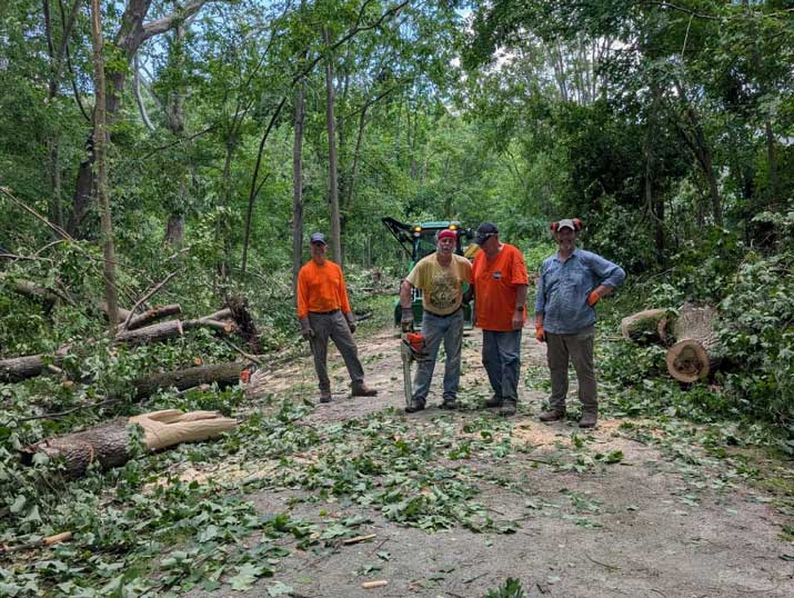
The savage winds that tore through Western Pennsylvania on Saturday, June 6, did not spare the Great Allegheny Passage. Trees came down along much of the trail’s length. By Monday, two days later, the GAP was fully open again.
That turnaround is worth pausing on.
The storm was no small thing. In Somerset County, the National Weather Service called it a non-tornadic straight-line wind event, with winds of 60 to 80 mph. Emergency crews logged 32 trees down and 27 wires down across the county between Saturday afternoon and evening. Laurel Hill State Park took a hard hit, losing power, water and sewer service and closing its campgrounds while crews worked to clear the roads. To the west, the National Weather Service confirmed six tornadoes across Fayette, Washington and Westmoreland counties, along with straight-line winds clocked at 90 to 100 mph.
And yet, within 48 hours, you could ride the GAP from end to end. That does not happen by itself.
The trail runs about 150 miles from Cumberland to Pittsburgh, and no single agency keeps it up. The work falls to a chain of local groups, most of them volunteer-run and staffed by people who live in or near the trail towns. They are the ones who show up with chainsaws after a storm. One good way to thank them is to send a few dollars to the group that looks after your stretch.
Here is the full lineup, organized from Cumberland to Pittsburgh:
- Mountain Maryland Trails. Cumberland, MD to the Pennsylvania state line, about 20 miles. mountainmdtrails.org
- Somerset County Recreation & Trails Association (SCRTA). The state line to Confluence and Ohiopyle, about 42 to 43 miles. This is the group that covers our stretch of trail. scrta.org
- Yough River Trail Council (YRTC). Layton through Connellsville to Bruner Run, about 23 miles, covering most of Fayette County. regionaltrailcorp.org
- Whitsett-Fayette Yough Trail Chapter (WFYTC). Roughly mile markers 41 to 46, about 5 miles. regionaltrailcorp.org
- Westmoreland Yough Trail Chapter (WYTC). Cedar Creek to West Newton, about 10.5 miles. bikewytc.org
- Mon/Yough Trail Council (MYTC). The Westmoreland County line through Boston to Port Vue, about 15 miles in Allegheny County. thebostontrail.com
- McKeesport Trail Commission. Within the City of McKeesport. mckeesport-pa.gov
- Steel Valley Trail Council. McKeesport through Duquesne, Whitaker and Homestead to the Three Rivers Heritage Trail connection, roughly 10 miles. steelvalleytrail.org
- Friends of the Riverfront. The Pittsburgh riverfront and the final GAP segment into Point State Park. friendsoftheriverfront.org
Thanks to Paul Weigman for the trail-group rundown,
The trail is open. The volunteers are tired. You know what to do.